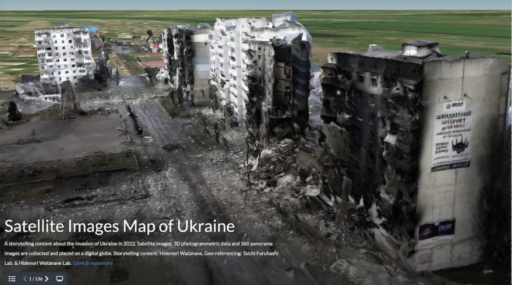
Pinpointing geographical location of satellite images helps paint larger picture of war. Russia’s aggression against Ukraine that began on February 24, 2022, continues to ravage the country, causing large-scale destruction and untold suffering to its people, as well as leaving the world reeling from shock waves felt around the globe. While the media keeps reporting on the situation day after day, it can be difficult to judge what information and sources can be trusted. We caught up with Professor Hidenori Watanave of the Graduate School of Interdisciplinary Information Studies, who has been visualizing data of Ukraine’s reality, through the eyes of an information design researcher. He uses satellite imagery and 3D models as tools, which not only visualize the war’s destruction, but could also open the door to a new kind of journalism. Below are excerpts from the interview.
Mapping satellite images of devastation
――The Satellite Images Map of Ukraine website you launched collects and maps satellite imagery of damage shot from the skies above Ukraine. Would you tell us more about this project?
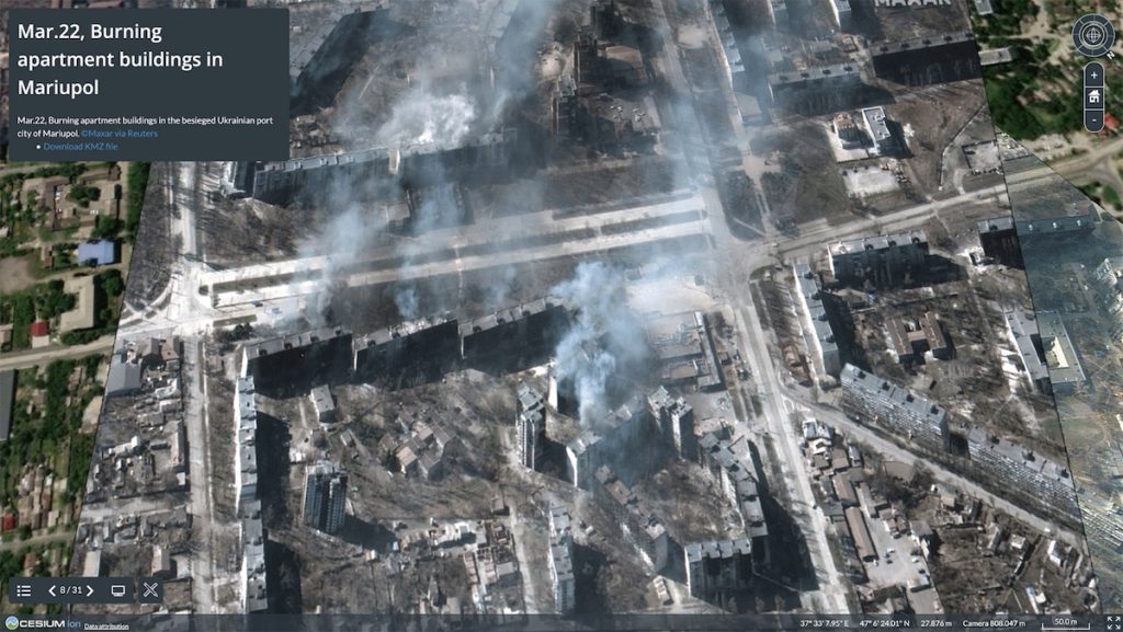
Companies like Maxar Technologies and BlackSky release distinctive images culled from the imagery collected by their proprietary satellites. Such images are circulated around the world through online articles and social media, but they do not provide detailed location data, making it difficult to pinpoint the precise spot in Ukraine that they represent. The only things we recognize are the names of places like the city Mariupol. What our team is working on is locating and identifying on Google Earth the detailed locations of the distributed satellite imagery. Once they’ve been identified, we adjust the aspect ratio, orientation and distortion of the images so that they overlap exactly with the actual locations, and then map and release them through the digital globe platform Cesium.


